Indonesia's Air Force flew an Airbus H225M Caracal on 3 Sept 2026 to water-bomb a 5-hectare fire 44 km from Nusantara in East Kalimantan, as peatland fires push haze over Borneo and disrupt flights.
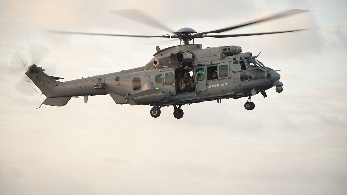
Cover image: Indonesian Air Force Caracal helicopter deployed to fight Nusantara wildfire — photo by MCSN Emily M. Blair, Public domain, via Wikimedia Commons.
The Indonesian Air Force deployed an Airbus H225M Caracal helicopter with a water bucket on 3 September 2026 to douse a forest and land fire that spread over five hectares near Sukomulyo Village, Sepaku, Penajam Paser Utara, about 44 kilometres from Nusantara, Indonesia's new capital in East Kalimantan. The sortie was ordered after hotspots flared again on land previously treated by soldiers and local officials, underscoring how fast peatland fires reignite even after initial containment.
The mission was detailed in a military information-centre statement received on 4 September and reported by ANTARA, which said the fire burned along the Penajam Paser Utara–Kutai Kartanegara border and that aerial water-bombing was flown on Thursday to accelerate ground efforts still underway. For travellers, the deployment is a reminder that Kalimantan's fire season is directly affecting flights, national parks and air quality across Borneo, with haze already pushing Sarawak's Serian district to emergency API 519 and prompting school closures across the border.
Where did the Nusantara fire burn and how was the Caracal used?
The fire site was mapped to Sukomulyo, Sepaku Subdistrict, on the district boundary roughly 44 km from the Nusantara core development zone. The statement said the blaze reignited and burned about five hectares after local military and civilian teams had earlier treated hotspots in the same area. The Air Force Caracal was tasked with water-bombing runs — hovering, scooping and dropping water from an underslung bucket — to cool smouldering peat and prevent spread toward settlements and the capital's construction logistics corridor. The military said operations were still underway when the release was issued and hoped the aerial drops would speed containment before winds pushed smoke toward Balikpapan and Samarinda.
The H225M Caracal — a 11-tonne medium lift type — is one of the few Indonesian military helicopters equipped for bucket operations and has been rotated between Kalimantan and Sumatra in recent days as forest fires forced wildlife evacuations in East Kalimantan and earlier triggered approval for 35 foreign firefighting aircraft to assist Kalimantan.
Why does a 5-hectare fire near Nusantara matter for travel?
Five hectares sounds small, but in Kalimantan's peat landscape it can generate dense, low-lying haze that drifts for hundreds of kilometres. This season's fires have already halted flights at Melalan Airport in East Kalimantan when visibility fell below one kilometre, cancelled 21 flights at Kualanamu after the Sinabung eruption, and pushed hotspot counts to 859 in West Kalimantan and 623 in Central Kalimantan in early September, according to Indonesia's disaster agency. The Nusantara blaze, though contained, sits along a road and river corridor used to move workers and materials to the capital site, so smoke and emergency road controls can delay site visits and tours that have grown as domestic interest in the new capital rises.
For regional travel, the linkage is direct: winds have carried haze to Sarawak and Penang in Malaysia and toward the Philippines' Palawan area, prompting health advisories. Travellers planning Borneo ecotourism, dive liveaboards from Balikpapan, or overland routes between Kalimantan and Sarawak should build in buffer for visibility-related flight delays and park closures, similar to the limited-tourism regime applied on Mount Rinjani during heightened fire risk.
What is the wider haze and firefighting picture this week?
Indonesia's fire response is now operating on multiple tiers: ground teams with handheld pumps, thermal-drone patrols , such as the UB Forest thermal-drone programme in East Java that sweeps 10 hectares per flight , and aerial assets including Caracals, Super Pumas and fixed-wing water bombers. The government has approved 35 foreign aircraft for Kalimantan, dispersed 8 tons of salt in Jambi cloud-seeding sorties to trigger rain, and placed 21 firms under legal action over 11,400 hectares burned across seven provinces. The Jambi operations alone logged 8 sorties and 15 hours 32 minutes of flight time from 26 August to 2 September, with the meteorological agency noting poor cloud availability until around 10 September and more favourable rain chances from early October.
| Fire metric (early Sept 2026) | Figure | Source |
|---|---|---|
| Hotspots West Kalimantan | 859 (up from 273) | BNPB 2 Sept |
| Hotspots Central Kalimantan | 623 (up from 253) | BNPB 2 Sept |
| Nusantara fire size (3 Sept) | 5 hectares | TNI/ANTARA 4 Sept |
| Distance to Nusantara core | 44 kilometres | Military statement |
| Foreign aircraft approved | 35 for Kalimantan | ANTARA 2 Sept |
What should travellers do if headed to Kalimantan or nearby?
Check airport NOTAMs and APHI/BMKG haze maps before flying to Balikpapan (BPN), Samarinda (AAP) or Pontianak (PNK); carry N95 masks; and reconfirm ecotourism and trekking permits, as regencies can close trails at short notice. Tour operators for orangutan and Dayak cultural tours around Kutai and Penajam are rerouting around smoky sectors, and some lodges have added flexible rebooking. If you have construction-related business in Nusantara, coordinate with the Nusantara Authority and allow extra road time around Sepaku, where fire trucks and water convoys may restrict heavy-vehicle movement during active ops.
Frequently asked questions
Where exactly was the Caracal deployed?
Over Sukomulyo Village, Sepaku Subdistrict, Penajam Paser Utara, on the border with Kutai Kartanegara in East Kalimantan , about 44 km from Nusantara , to water-bomb a 5-hectare peatland fire on 3 September.
What aircraft is the Caracal?
The Airbus H225M Caracal (formerly EC725), an 11-tonne twin-engine helicopter operated by the Indonesian Air Force for combat search, lift and bucket firefighting. It was flown with an underslung water bucket for this mission.
Is Nusantara safe for visitors?
The capital construction is not directly threatened, but smoke can degrade air quality and visibility nearby. The military said firefighting was still underway on 4 September and urged caution. Check local air-quality readings and follow any regency-level movement guidance.
Will flights be affected?
Possibly. Kalimantan airports have seen visibility halts this week at Melalan and delays at Palangka Raya and Banjarmasin. Monitor your airline and BMKG visibility forecasts the morning of travel.
How does this relate to earlier haze stories?
It is part of the same 2026 peatland fire season that prompted 35 foreign aircraft approval, Jambi cloud seeding with 8 tons of salt, and legal action against 21 firms. Each new hotspot, like Nusantara's 5 hectares, requires rapid air response to stop it scaling.