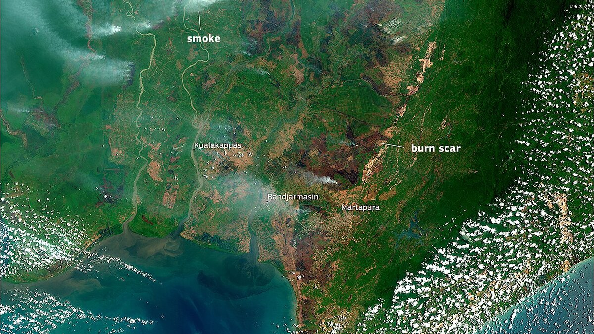
Indonesia triggered ASEAN Level 3 haze alert on 26 Aug 2026 as West Kalimantan hotspots jumped to 859 and haze drifted to Malaysia, Singapore and the Philippines.
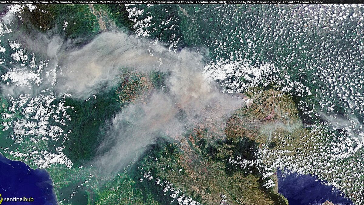
Cover image: Satellite view of haze and burn scars over peatland in southern Borneo during ASEAN Level 3 alert — photo by European Union, Copernicus Sentinel-2 imagery, Attribution, via Wikimedia Commons.
Indonesia is coordinating with ASEAN neighbours under a Regional Alert Level 3 for transboundary haze, the highest alert tier, which was activated on 26 August 2026 and requires every member to file daily situation reports with haze trajectory maps. The Foreign Ministry said on 5 September 2026 that Jakarta is meeting its reporting duties as smoke from Borneo peatland fires drifts toward Malaysia’s Sabah and Sarawak, Singapore, Brunei and the Philippines including Manila.
Spokesperson Vahd Nabyl A. Mulachela said Indonesia consistently prioritises cooperation with neighbouring countries and maintains good bilateral relations while continuing to fulfil its obligations to submit daily reports. The mechanism is run through the ASEAN Secretariat acting as interim office of the ASEAN Coordinating Centre for Transboundary Haze Pollution Control, a structure member states agreed to strengthen after last year’s fire season.
What triggered Level 3 and what has to happen now?
Level 3 is not declared lightly. It means regional monitors see a high risk of smoke crossing borders for several days and need coordinated data. Since activation, ministries send daily haze trajectory maps, hotspot counts and wind forecasts so neighbours can issue health advisories and airlines can anticipate visibility constraints.
For travellers, Level 3 does not mean closed borders or automatic cancellations. It is an early warning that intermittent flight delays, diversions and poor air quality readings become more likely, especially for short hops over Borneo, the Malacca Strait and the Java Sea. Airports most exposed are those downwind of the main burn zones. By contrast, hubs farther south such as Serian in Sarawak, where API already hit 519 and schools closed, show how quickly readings can spike once plumes arrive.
How bad are the fires right now?
Hotspot tallies from the Forestry Ministry’s Sipongi system as of 1 September 2026 underline why the alert is in force:
- West Kalimantan: 859 hotspots, up from 273
- Central Kalimantan: 623, up from 253
- South Sumatra: 89, up from 20
- South Kalimantan: 73, up from 22
- Jambi: 4, up from zero
- Riau: zero, unchanged
The rise is fastest in western and central Borneo, where peatlands hold thick organic soil that can smoulder for weeks after surface flames are out. That matches what ground crews see: helicopters and water-bombing sorties in Jambi and South Sumatra have suppressed new ignitions, but older peat fires in Ketapang and Kapuas continue to vent smoke.
Outside Borneo, fire-related disruptions continue to ripple through air networks. Travellers planning Sumatran itineraries should note that West and Central Kalimantan already saw the steepest hotspot surge in the season, and the 5 September ASEAN update confirms those plumes are now moving north and east.
Where is the smoke showing up?
Antara’s 5 September report lists visible impacts beyond Indonesia: light haze over Sabah and Sarawak, Singapore at the southern tip of the peninsula, Brunei on Borneo’s north coast, and as far north as Manila in the Philippine archipelago. Those readings are consistent with south-westerly monsoon winds that curve around Borneo’s spine and funnel smoke through the Sulu and South China seas.
So far the heaviest domestic transport impacts have been on Borneo itself. Melalan Airport in East Kalimantan halted flights this week when visibility fell below 1 kilometre, and Penang recorded a 20 percent drop in heritage walking tours as haze softened visibility. Long-haul gateways such as Changi, KLIA and Soekarno-Hatta usually keep operating with instrument approaches, but early-morning fog-plus-haze can push delays into the mid-morning bank.
What should travellers do this week?
If you have a Borneo or Sumatra flight in the next 72 hours: check the airline app for retimings, arrive with extra connection margin, and keep an N95 mask for tarmac buses and open-air terminals. Mask mandates are not in force, but authorities advise sensitive groups to limit outdoor exposure when API/PSI passes 100.
If you are heading to Singapore, Johor or Borneo resorts: monitor hourly API/PSI on MyCuaca (Malaysia), NEA (Singapore) and AQICN. Rebook high-exposure activities like hill trekking or island-hopping for early morning when winds are calmer, and prefer hotels with filtered air conditioning rather than open-air villas.
If you are transiting: allow at least three hours between a domestic Borneo leg and an international departure. Insurers generally treat haze as a weather event, so keep boarding-pass screenshots and airline delay notices for claims.
Indonesian officials stress that daily maps and fire suppression continue. Whether Level 3 steps down will depend on rain. BMKG forecasters see poor cloud formation until about 10 September, with the first significant monsoon showers not expected until early October in western Kalimantan.
Frequently asked questions
What does ASEAN Alert Level 3 mean for travellers?
Level 3 is the highest regional haze alert under the ASEAN Coordinating Centre for Transboundary Haze Pollution Control. It requires daily situation reports with trajectory maps from all members. For travellers it does not close borders, but it signals that smoke plumes are crossing borders and flight delays or poor air quality in Malaysia, Singapore, Brunei and the Philippines are more likely over the next days.
Which Indonesian regions are driving the current haze?
Forestry Ministry Sipongi data as of 1 September shows West Kalimantan 859 hotspots (up from 273) and Central Kalimantan 623 (from 253). South Sumatra rose to 89, South Kalimantan to 73, Jambi to 4, Riau held at zero. The bulk of the increase is in western and central Borneo peatlands.
Will flights to Bali or Jakarta be affected?
Most international hubs like Jakarta Soekarno-Hatta and Bali Ngurah Rai are south of the main Borneo burn belt, but winds can shift. East Kalimantan airports have already seen smoke disruptions at Melalan, and Kualanamu near Sumatra's Sinabung faced ash closures. Check your airline and air-quality app before inter-island hops.
Is it safe to travel to Singapore or Kuala Lumpur during Level 3?
Both cities monitor PSI/API hourly. Short trips are still viable, but sensitive groups should limit outdoor activity when readings exceed 100, carry N95 masks, and allow buffer time for flight retimings. Hotels and Changi/KLIA have indoor air filtration and rarely cancel for haze alone.