Mount Semeru erupted at 7:51am Sept 6 with a 1,000m ash column; trails closed, 170 hikers evacuated as 3,000+ hectares of forest burn. Level III Alert.
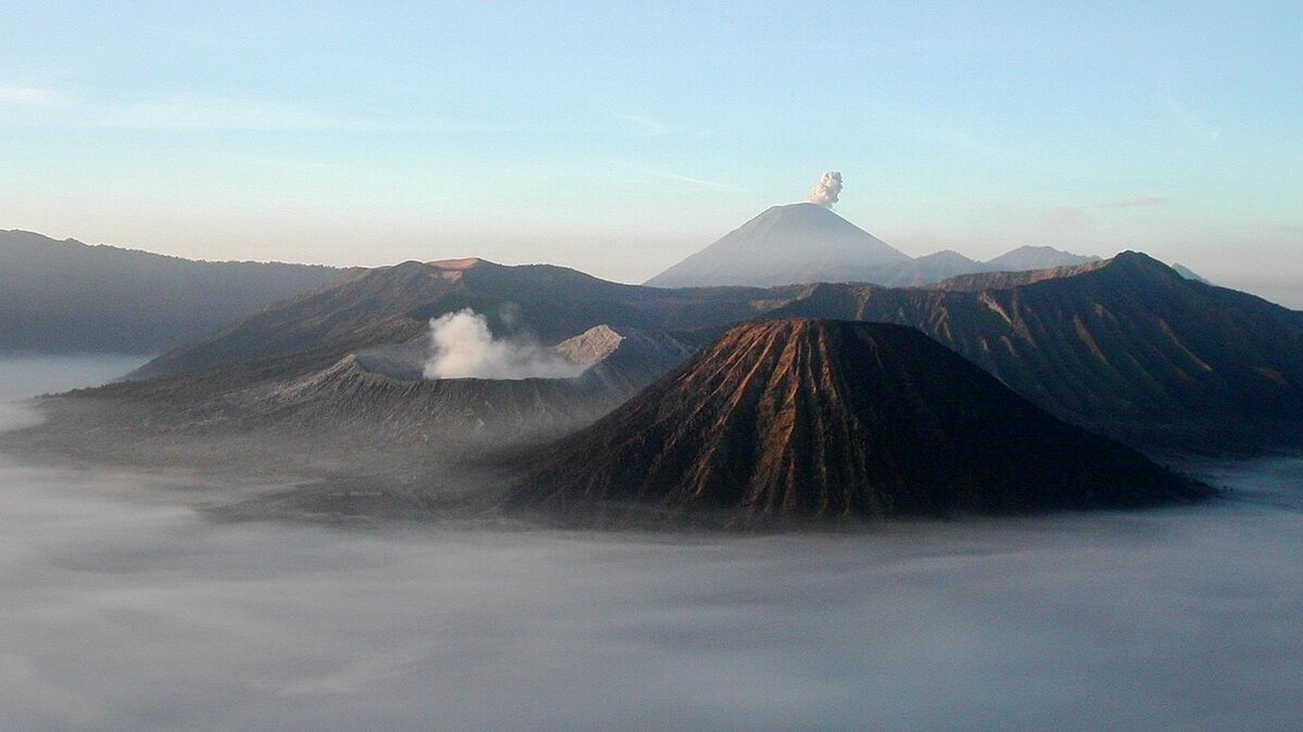
Cover image: Mount Semeru smoking behind the Tengger caldera at sunrise — photo by Thomas Hirsch (= user Ravn), CC BY-SA 3.0, via Wikimedia Commons.
Mount Semeru, Java's highest mountain, erupted at 7:51 am local time on Sunday, September 6, sending a thick white-to-gray ash column about 1,000 meters above its summit. The eruption lasted 102 seconds with a maximum seismograph amplitude of 23 mm, observation post officer Sigit Rian Alfian said. With the volcano at Level III (Alert) and forest fires burning across more than 3,000 hectares of its slopes, authorities have kept hiking trails closed and 170 trekkers have already been evacuated.
The ash column rose to roughly 4,676 meters above sea level and drifted eastward, Republika reported, as cited by Tempo on September 6. The eruption compounds a fire emergency: data from the Bromo Tengger Semeru National Park (TNBTS) shows the wildfire affecting over 3,000 hectares, still unextinguished on Sunday morning and spreading across steep slopes where difficult terrain complicates firefighting.
Which areas around Semeru are off-limits?
Under Alert status, the exclusion map is precise. No outdoor activities are allowed in the southeastern sector along the Besuk Kobokan River within 13 kilometers of the summit, the eruption's epicenter. Activities are also banned within 500 meters of the Besuk Kobokan riverbanks beyond that zone, because hot clouds and lava flows can travel up to 17 kilometers from the summit. A five-kilometer radius around the crater is closed against ejected incandescent rock. Sigit warned of pyroclastic flows, lava avalanches and lahars along river channels running off the summit, naming the Besuk Kobokan, Besuk Bang, Besuk Kembar and Besuk Sat streams, with smaller tributaries also able to carry lahars.
170 hikers evacuated as trails close
TNBTS closed Semeru's hiking trails to protect trekkers and support firefighting. Antara reports all 170 hikers on the mountain when the fire broke out were safely evacuated after the blaze approached the main trekking route. The closure is part of a wider clampdown: with fires raging across the archipelago, the Forestry Ministry has temporarily shut nine high-risk national parks and restricted entry to others.
The double emergency lands one day after Anak Krakatau's ash shut Jakarta airspace and cancelled more than 200 flights. Two erupting volcanoes in two days underline how much of Java's adventure-tourism belt is currently under restriction. Travellers with trekking plans should also note the parallel enforcement drive against the 113 wildfire suspects named across the country, and check the status of Ijen crater, which closed days earlier as fires neared its hiking route.
Can you still visit East Java?
Yes, outside the exclusion zones. Malang, Surabaya and the Bromo viewpoints outside restricted sectors remain open, though haze from fires can dull the views. Anyone heading to the highlands should monitor TNBTS and disaster-agency updates daily: alert levels, wind direction and fire lines are all moving quickly this week.
Frequently asked questions
Did Mount Semeru erupt today?
Yes. Semeru erupted at 7:51 am local time on Sunday, September 6, 2026, producing a 1,000-meter ash column over 102 seconds. Alert status remains Level III.
Are Semeru hiking trails open?
No. The national park authority closed all hiking trails because of the eruption plus forest fires covering 3,000+ hectares. A total of 170 hikers were evacuated safely.
Is it safe to travel to East Java now?
Areas outside the 13 km sectoral and 5 km crater exclusion zones remain accessible, but check daily updates: ash drift, fire lines and alert levels are changing fast.